Hike to Summit of Mt. Lassen
Mt. Lassen Volcanic National Park

A highlight of our Mt. Lassen park experience was climbing to the top of Mt. Lassen itself. The mountain is a dormant volcano that last erupted during the years 1914-1917. When I first saw the mountain from a distance, I said "We're going to climb THAT? It seemed too big to climb.

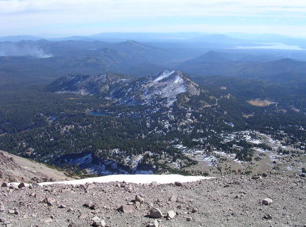
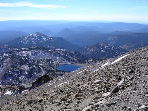
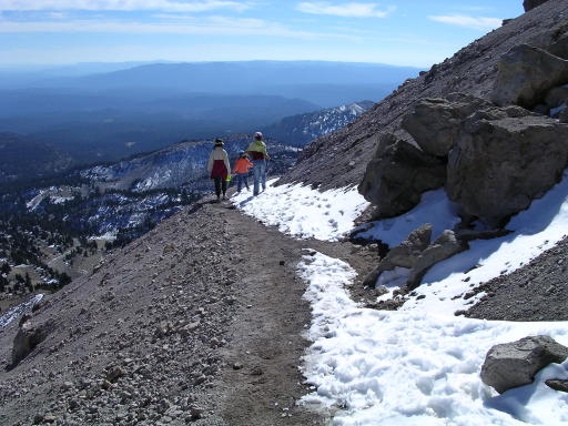
The hike is about 2-1/2 miles each way and has an elevation change of 2,000 feet. (The parking lot is at 8,000 feet and the peak is at 10,000 feet.) Most of the trail was rocky, with no trees or vegetation except at the lower elevations. Below is a typical view from the trail.
 
junk

I brought 2 half-liter bottles of water, which was not enough. Fortunately, the fresh snow provided a cool source of water. I would scrape off the top layer of snow to get rid of any settled dust and dirt, and then scoop up enough snow to make a fluffy 6-inch-diameter snowball. I would carry the snowball and munch it like a snow cone.

The trail zig-zags up the steep slopes of the mountain, so that it's easy for city folks like us.

Mt. Lassen trail switchbacks

As you approach the summit, a sign points out that you are looking at the youngest rocks in California. They were produced by the 1914-1917 eruption.

The summit provides good views, but the rocks did not look as much like lava as the rocks at Cinder Cone. I thought Cinder Cone was more exciting, although a real geologist would probably enjoy visiting both places equally.

During the descent, my daughter always walked as far as possible from the steep, cliff-like side of the trail, even if it meant trudging through snow instead of walking on solid ground.

Mt. Lassen walking on snow

We completed the round-trip hike in about 5 hours, which included a lot of rest stops. Upon completion of the hike, we started the long drive home to the Bay Area.

For a more detailed description of the hike to the top of Mt. Lassen, go to Kevin's Hiking Page.


Back to Mt. Lassen Trip home page

©2005 Gray Chang